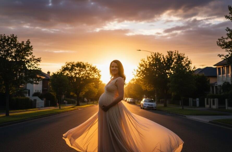
Glen Iris, with its tree-lined streets, stunning period homes, and lush green spaces like Gardiners Creek Reserve, offers a unique blend of urban charm and natural beauty. But have you ever wondered what these picturesque surroundings look like from above? At Image by SD, we specialise in capturing Glen Iris’s stunning landscapes with drone photography, providing breathtaking aerial perspectives that reveal the true grandeur of this beloved Melbourne suburb. From sweeping residential vistas to intricate architectural details, our drone photography services offer a fresh, elevated view of your world.
The Unique Appeal of Aerial Views in Glen Iris
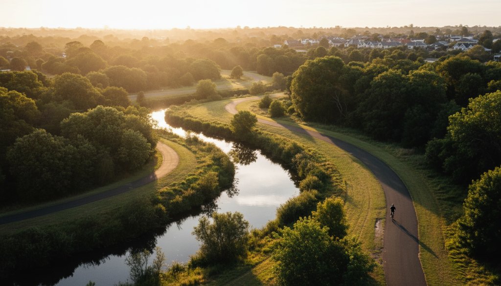
There’s a distinct charm to Glen Iris, from the tranquil flow of Gardiners Creek, popular with cyclists and walkers, to the magnificent architecture lining streets like High Street and Burke Road. Traditional ground-level photography can only capture so much. Drone photography, however, opens up a world of possibilities, showcasing the expansive properties, manicured gardens, and the overall leafy, affluent feel of the area. Imagine showcasing the full scope of a property backing onto a parkland or the impressive scale of a commercial development in its local context. It’s about more than just a photo; it’s about storytelling from an entirely new vantage point.
Elevating Glen Iris Properties with Drone Photography
For real estate agents, developers, and homeowners in Glen Iris, drone photography is an invaluable tool. It allows potential buyers to truly grasp the scale, layout, and neighbourhood context of a property in a way that traditional photos simply cannot. From sprawling estates to modern townhouses, an aerial perspective highlights unique features like large backyards, swimming pools, proximity to schools, or the elegant streetscape. Our Melbourne real estate photography, enhanced with drone capabilities, ensures your listing stands out in a competitive market.
Beyond Real Estate: Diverse Applications for Aerial Imaging
While property marketing is a significant application, the versatility of drone photography extends far beyond. Consider:
- Commercial & Infrastructure Projects: Documenting the progress of construction, surveying land, or capturing the finished grandeur of commercial sites across Boroondara Council.
- Events & Gatherings: Capturing the vibrancy of outdoor events, festivals, or private celebrations in Glen Iris, offering a dynamic and comprehensive visual record.
- Landscape & Environmental Studies: Documenting changes in natural areas like Gardiners Creek Reserve, or simply appreciating the area’s natural beauty.
- Marketing & Branding: Businesses can use stunning aerial imagery to enhance their brand presence, showcasing their location, facilities, or local environment. Explore more about our Melbourne aerial photography services.
Why Choose Image by SD for Your Glen Iris Drone Project?
At Image by SD, we combine advanced drone technology with a keen eye for composition and light. As local Melbourne photographers, we possess an intimate understanding of Glen Iris, knowing the best times and angles to capture its unique character. Our fully licensed and insured drone pilots adhere to all CASA regulations, ensuring safe and professional operations. We pride ourselves on delivering high-resolution, professionally edited images and videos that exceed expectations, transforming your vision into captivating aerial art.
Ready to see Glen Iris from an extraordinary new perspective? Whether you’re selling a home, documenting a project, or simply wish to capture the beauty of your surroundings, Image by SD is here to help you achieve your aerial photography goals. Contact us today to discuss how we can elevate your visual story with stunning drone imagery.