There’s a unique magic to seeing the world from above, a perspective that transforms the familiar into something truly extraordinary. For the expansive rural properties and natural beauty of Victoria’s own Koo Wee Rup, this magic comes alive through expert Koo Wee Rup drone photography for stunning rural landscapes. Imagine capturing the sweeping vistas, the intricate patterns of agricultural land, or the serene flow of local waterways – all from an elevated viewpoint that a traditional camera simply cannot reach.
The Undeniable Appeal of Koo Wee Rup from the Sky
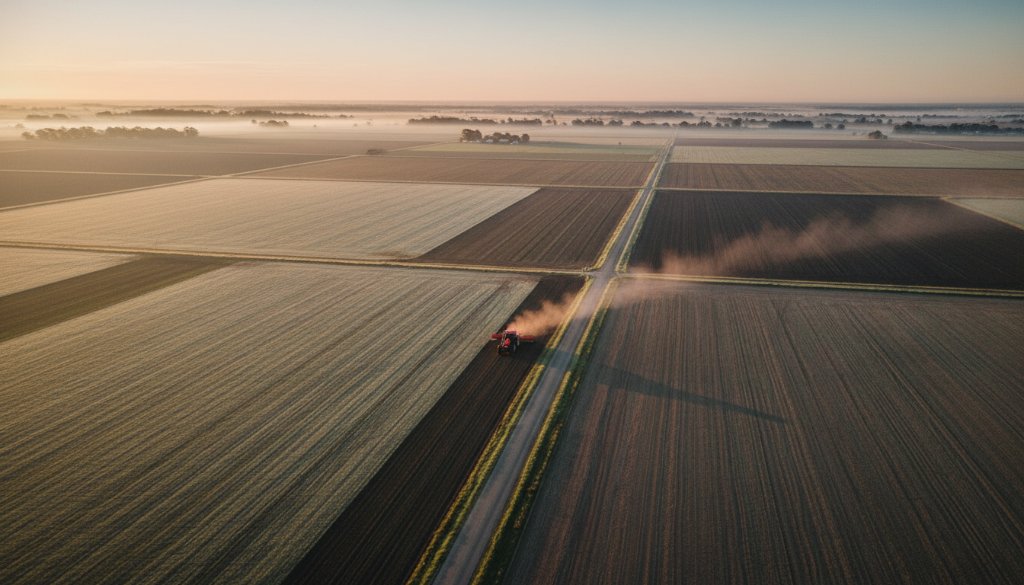
Koo Wee Rup, nestled within the picturesque Cardinia Shire, boasts a landscape characterised by rich agricultural land, market gardens, and a distinctive rural charm. From ground level, its beauty is evident, but from above, its true grandeur is revealed. Drone photography offers an unparalleled opportunity to showcase the scale and unique features of the area, whether it’s for documenting a large farm, highlighting a property’s boundary, or simply celebrating the stunning natural environment.
The vast, flat plains that define much of Koo Wee Rup create an incredible canvas for aerial imagery. We can capture the geometric beauty of cultivation, the winding paths of rural roads, and the distant Dandenong Ranges providing a majestic backdrop. It’s about more than just a photo; it’s about telling a story that only an aerial perspective can convey, bringing out the essence of this vibrant Victorian region.
Transforming Your Perspective with Aerial Expertise
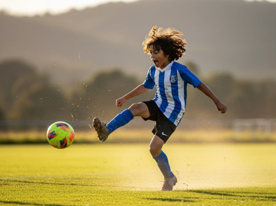
At Image by SD, we understand the nuances of capturing compelling aerial visuals. Our drone photography services are tailored to highlight the best aspects of your Koo Wee Rup property or project. Whether you’re a farmer wanting to showcase your land’s productivity, a real estate agent aiming to provide buyers with a comprehensive view, or a business looking for unique promotional imagery, drones offer a dynamic solution.
Unveiling Koo Wee Rup’s Beauty Through Drone Lens
Consider the benefits:
- Comprehensive Property Overviews: Drones provide a full scope of large properties, ideal for land sales or agricultural planning.
- Unique Marketing Material: Stand out with breathtaking images that capture attention and tell a richer story.
- Accessibility: Reach vantage points impossible or unsafe for traditional photography.
- Event Coverage: Capture large outdoor gatherings or rural events with an impressive, all-encompassing view.
We pride ourselves on our professionalism and adherence to all aviation regulations, ensuring safe and spectacular results every time. Our advanced drone technology allows for high-resolution stills and cinematic video footage, giving you a versatile suite of assets.
Why Choose Image by SD for Your Koo Wee Rup Aerials?
As a Melbourne-based photography business with deep local knowledge, Image by SD brings expertise directly to Koo Wee Rup. We don’t just fly drones; we craft stunning visual narratives. We understand the local geography, the optimal times for lighting in rural settings, and how to best compose shots that reflect the genuine character of this area. Our portfolio includes diverse projects, from dynamic real estate photography to captivating commercial photography, demonstrating our ability to deliver exceptional visual content.
We know that Koo Wee Rup is more than just a dot on the map; it’s a community with a rich agricultural heritage and evolving landscapes. We aim to honour that heritage and showcase its future potential through the power of drone photography. For more information about the local area, you can visit the Cardinia Shire Council website or explore other attractions on Visit Victoria.
Ready to see your Koo Wee Rup property or project soar? Let Image by SD elevate your vision with professional drone photography. We’re here to help you capture those epic aerial moments that truly make an impact.